Felipe Geremia-Nievinski, Douglas Bueno Leipelt, Iuri Mendonça Tinti, Manuella Anaís Rodrigues Fagundes, Maurício Kenji Yamawaki and Vitor Hugo de Almeida Junior There is an increasing need for coastal sea level…
Read More
Felipe Geremia-Nievinski, Douglas Bueno Leipelt, Iuri Mendonça Tinti, Manuella Anaís Rodrigues Fagundes, Maurício Kenji Yamawaki and Vitor Hugo de Almeida Junior There is an increasing need for coastal sea level…
Read More
Nicolas Barberis, Enrique Vetere P2P Container is a solution designed to help shipping companies keep track of their containers at a marginal cost and thereby gain a competitive advantage. It…
Read More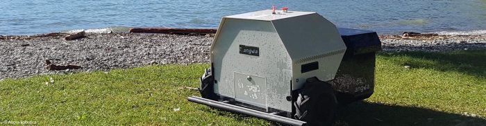
Bilal Tariq, Lukas Wiesmeier, Karl Schulz Minor rubbish left in grass and gravel areas is an ecological and economic problem. Since conventional sweeping machines designed for flat asphalted surfaces cannot…
Read More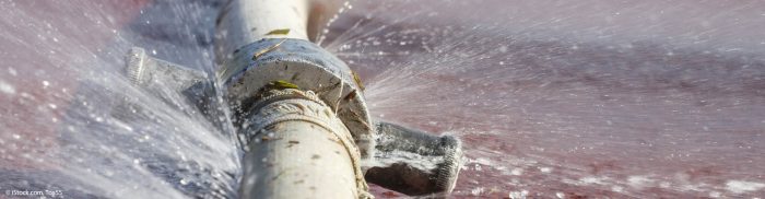
Riccardo Marchetto Water leakage is a worldwide problem due to the old age of pipeline networks. Meanwhile, subsoil investigations are done with acoustic technology that requires contact with pipelines, which…
Read More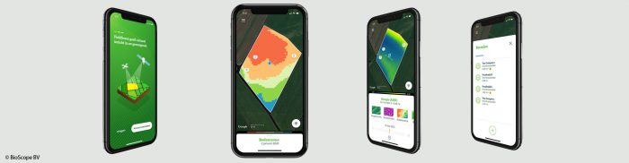
Tamme van der Wal The FieldScout app revolutionises the way farmers perceive precision agriculture by making it easy, accessible, and affordable. FieldScout helps farmers make use of maps of their…
Read More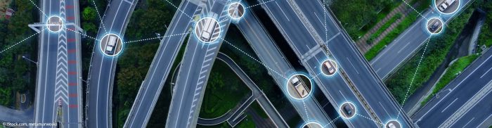
Francesco Marchioni, Alberto Fontebasso and team The SMART project provides innovative traffic management software and supports smart urban mobility. The system combines the immediacy and precision of Galileo positioning data…
Read More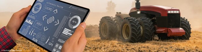
Enrico Abbati „Dood“ is an autonomous agricultural machine that is capable of performing routine operations without human involvement. The machine has GNSS positioning for path recognition and is scheduling the…
Read More
Stefan Frey, Srinivas Setty, Luisa Buinhas, Christoph Bamann Due to the growing number of space objects, which include both operating satellites and space debris, the chances of catastrophic collisions have…
Read More
Higinio González Jorge, Joaquin Martinez Sánchez, Luis Miguel González de Santos and Miguel Angel González de Santos Large structures such as dams, wind farms, bridges, or buildings require continuous…
Read More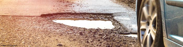
Marco Trucchi, Christophe Biondi Pothole Mapper is a service that provides liveupdated maps of road defects like potholes, cracks, and worn portions (along with their precise severity and position) thanks…
Read More