

Tamme van der Wal
The FieldScout app revolutionises the way farmers perceive precision agriculture by making it easy, accessible, and affordable.
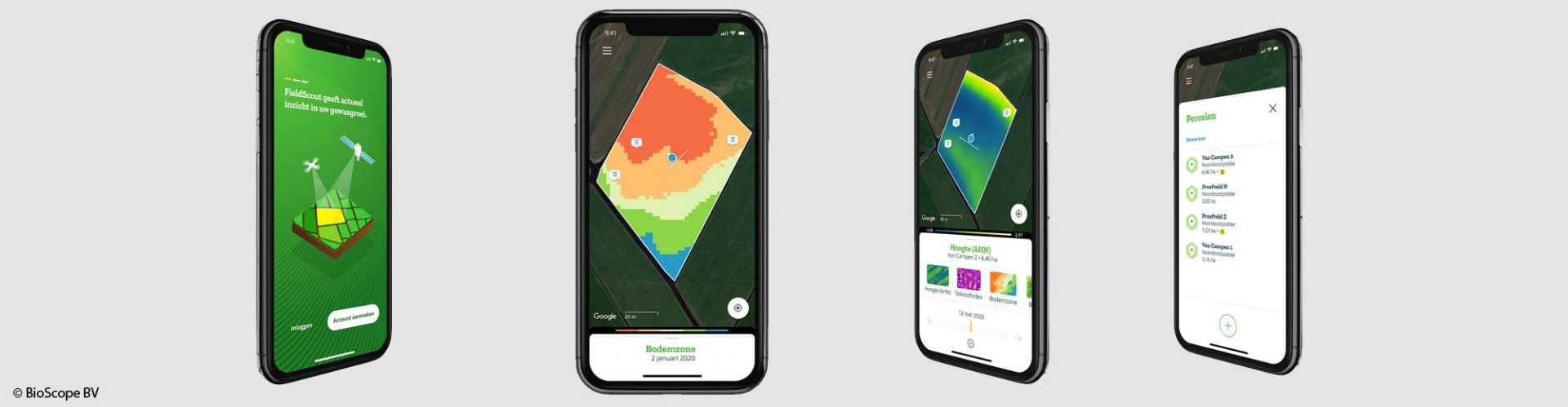
FieldScout helps farmers make use of maps of their soil and crops based on satellite images. With this system, farmers have these images in the palm of their hand. Thanks to GNSS, they can also view themselves amid the vivid colours of satellite data and navigate to problem areas or other specific zones. Farmers can then save their field observations by making geotagged notes and photos. With FieldScout, farmers can place their smartphone in their tractor’s dashboard mount while driving and visualise themselves and their spraying boom within a satellite image. They can take full control and manually adjust rates while moving across the satellite task map. In addition, FieldScout’s information can be offered through a service where farmers can simply order the satellite information they need right when they need it.
Contact