Jorge Garcia del Arco AquaRADAR is a contactless real-time solution for water quality analysis that is designed to improve environmental and public health. Water is life. It is vital, scarce,…
Read More
Jorge Garcia del Arco AquaRADAR is a contactless real-time solution for water quality analysis that is designed to improve environmental and public health. Water is life. It is vital, scarce,…
Read More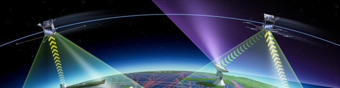
Pablo Ruiz Sánchez, Mario Castro de Lera Deep Blue Globe is a startup based in Darmstadt (Germany) that develops artificial intelligence solutions based on Earth observation data, satellite navigation,…
Read More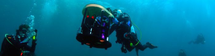
Dr. Joost den Haan, Raja Kandukuri, MSc, Guy Rigot, MSc, Dr. Hannah Brocke, Nils Oehlmann, MSc While Earth’s atmosphere and ground surfaces are well monitored by satellites, there are no…
Read More
Dariusz Tanajewski, Grzegorz Grunwald It is surprising that while mankind is researching the surface of Mars and Pluto, we still know little about the bottoms of the lakes, seas, or…
Read More
Nourredine Houari, Thierry Amieil Small pleasure boats are not detectable by maritime traffic systems because they are currently not required to carry location transmitter devices. Indeed, most of these boats…
Read More
Philippos Beveratos, Jean-Robert Malandra YOOR is a personalised social app for recreational boating. To address the lack of real-time information on congestion at mooring locations, it helps users find appropriate…
Read More
Giacomo Mangani, Alessandro Cantore DESCRIPTION The Marine Telepass is an innovative system designed to provide easy, remote- controlled access to protected marine areas. Navigation restrictions in these areas can be…
Read More
Patryk Jurkowski, Patrick Henkel DESCRIPTION GPS satellites transmit code and carrier phase signals that can be used for positioning. Low-cost receivers use only the code signal, and are thus accurate…
Read More
Dr Kutz Arrieta DESCRIPTION Port operations involve a considerable amount of time-consuming tasks and safety gaps. Information and notifications can be stored, connected through networks and synchronised in real time…
Read More
Dr Tim Springer DESCRIPTION Today’s high-accuracy Global Navigation Satellite System (GNSS) market, meaning positioning at the 1-100 mm level, is mainly a field for universities and scientific institutes. In the…
Read More